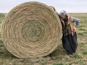


The author, Mary Margaret Hansen, gauging the size of the bale in northern Montana.
Editor’s Note: Texas artist Mary Margaret Hansen, who’s known for her photo-based work as well as curatorial and public art endeavors, went in search of her family’s roots. The journey led Hansen to cross international borders and to consider an immigrant’s tale of coming to America. This is part one of a series.
With Seattle in the rearview mirror, my sister Kate Maher and I headed eastward across Washington State on a two-week road trip that would take us across the Idaho panhandle through Glacier National Park in Montana, and northward into Canada. We would meet our brother John Thompson — flying in from Texas — in Saskatoon, Saskatchewan.
The three of us were on a mission to find that parcel of prairie on which our grandparents homesteaded as wheat farmers from 1916 to 1924. We’d seen the place in faded family photos. We’d read the prairie memoir our grandmother wrote and tucked away.
We decided to seek out the land that had so influenced the lives of our paternal grandparents, Lewell and Shirley Keyes Thompson.
Kate and I were sure that the sole impetus for our road trip was family history, but as with any road trip worth its name, it became a panoply of the unplanned and unexpected. Countless times during our 2,900-mile sojourn, and mostly at my bidding, Kate stopped on the highway’s shoulder for whatever we (I) couldn’t let pass without comment or iPhone photo.
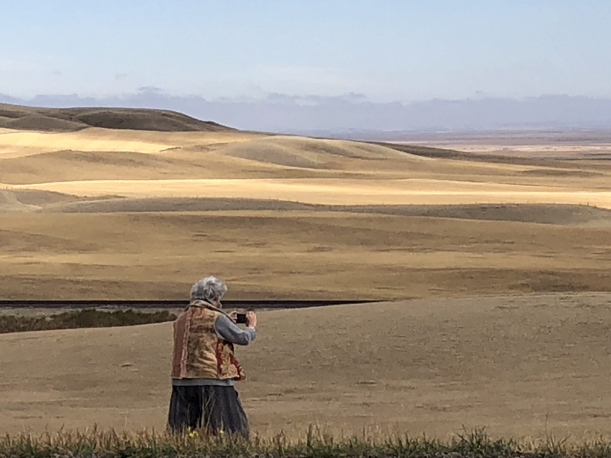
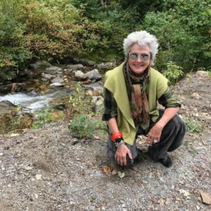
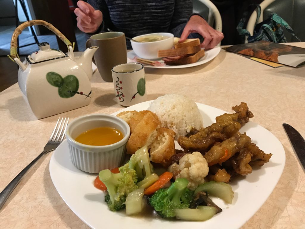
We stood beside bales of feed in northern Montana to measure their girth and height. We gathered pebbles on river banks, examined forest ferns touched by frost, and ate in local restaurants with signs heralding Canadian Chinese cuisine.
Outdoor Dining with Bering's


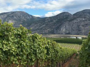
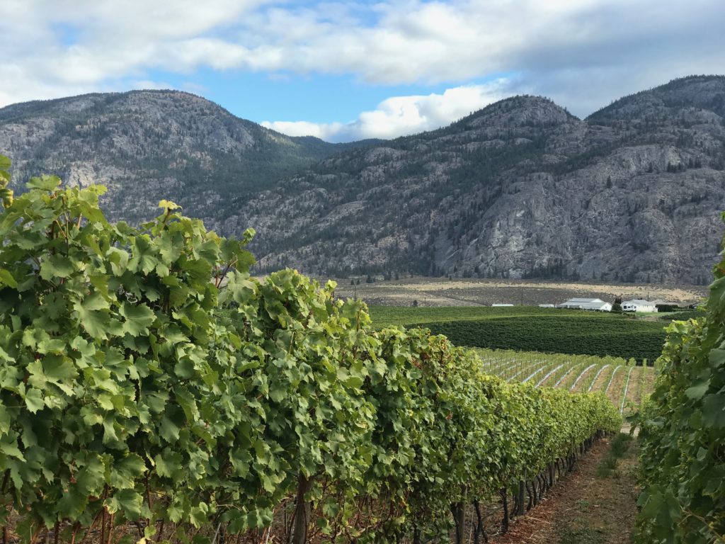
We photographed endless “amber waves of grain” along pencil-straight stretches of highway, admired lush vineyards and orchards in British Columbia, watched bison from afar in Grasslands National Park, discovered that Alberta has more dinosaur remains than any place on earth, and soaked in a hot springs outdoor pool in Radium, British Columbia.
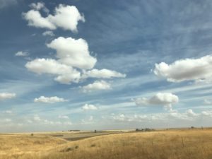
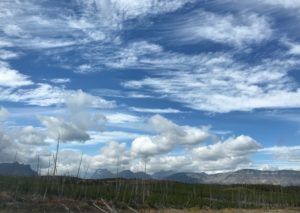
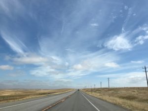
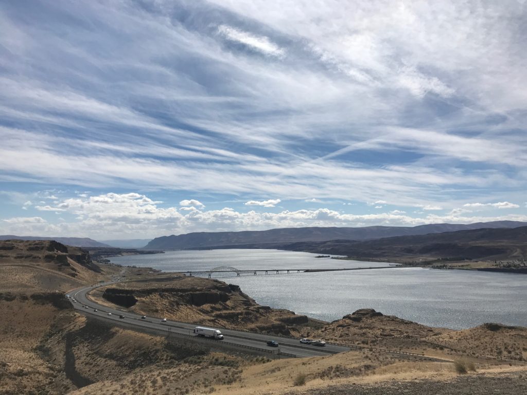
Everywhere and always, we were surrounded by panoramic skies. And every evening, we perused brochures collected from hotel lobbies and visitor centers, invariably adding mini-destinations to the itinerary.
Here’s our story.
Big Skies
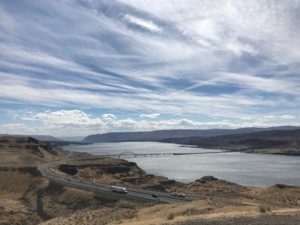
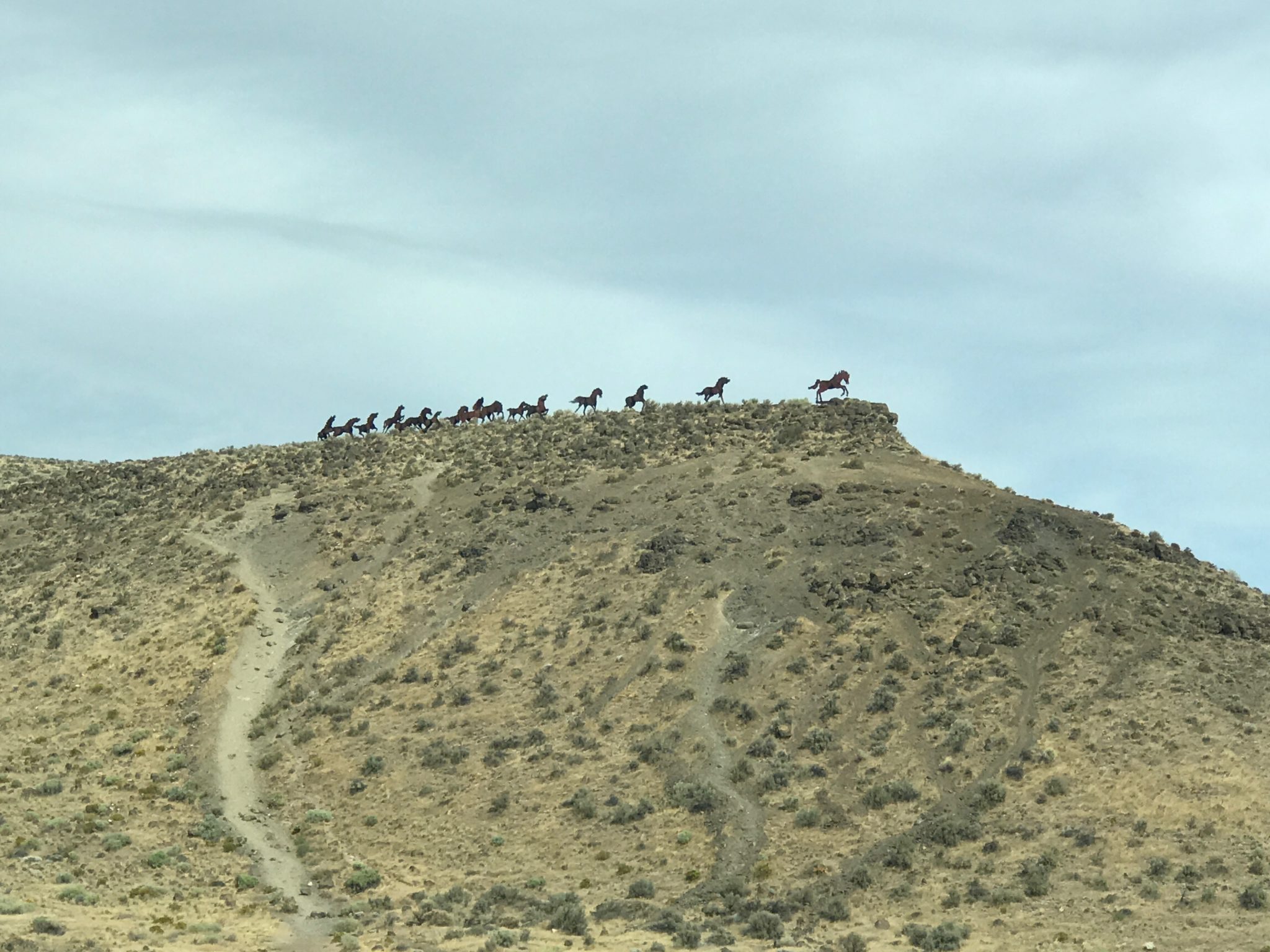
Our first stop across Washington State was high on a lookout point over the Columbia River Gorge. The view was immense, the first of many monumental landscapes with omnipresent big sky.
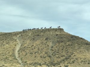
Above the overlook, Wild Horses Monument swept in silhouette across a mountain top, a sculpture created by Chewelah artist David Govedare, for Washington State’s 1989 Centennial. See the artist’s grand addition planned to complete the popular public artwork here.
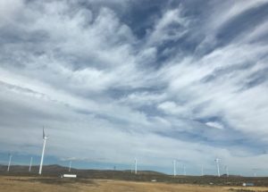
The landscape changed abruptly soon after crossing the Columbia River. We were suddenly surrounded by rolling wheat fields, and found tumbleweeds stuck against barbed wire fences. When wind farms appeared on the horizon, it suddenly felt a lot like driving across West Texas.
Until that moment, I didn’t realize that wind farms, tumbleweeds and rolling landscapes were just the first of many similarities between Texas and places we’d encounter on this sojourn.

Idaho Calling
We knew not one thing about Idaho’s history when we crossed the state line into Idaho’s panhandle heading toward the town of Coeur d’Alene. Relying on Google searches and those brochure racks, we learned that French trappers and fur traders were the first white men to enter this vast western land.
They found indigenous people settled along the banks of lakes and rivers, and because the trappers thought these people to be shrewd “sharp-hearted” traders, they named them the “Coeur d’Alene.” We discovered that name is also affixed to a town, a lake and a river.
The town of Coeur d’Alene rests on the northern edge of Lake Coeur d’Alene and cultivates a bustling tourism business. Its downtown is loaded with vacation condos and art galleries. Kate booked a room at Blackwell Boutique Hotel, a stately old home with verandas and servant’s stairs to a third floor, where we were ensconced in a comfy attic room.
Before turning out the lights, we read the entire Chamber of Commerce Visitor’s Guide for Wallace, Idaho, and were convinced it was a must-stop place on our way to Montana.
We learned that northern Idaho is loaded with silver. In fact, Idaho is one of three top silver producing districts in the world, along with Mexico and Bolivia. The discovery of silver in 1884 brought thousands of miners into the region, and one of the new towns that grew rapidly was Wallace.
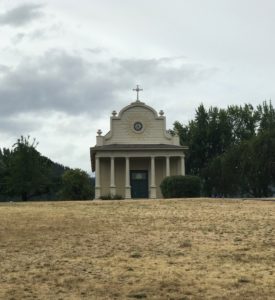
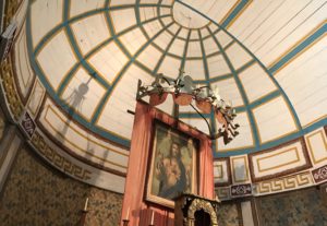
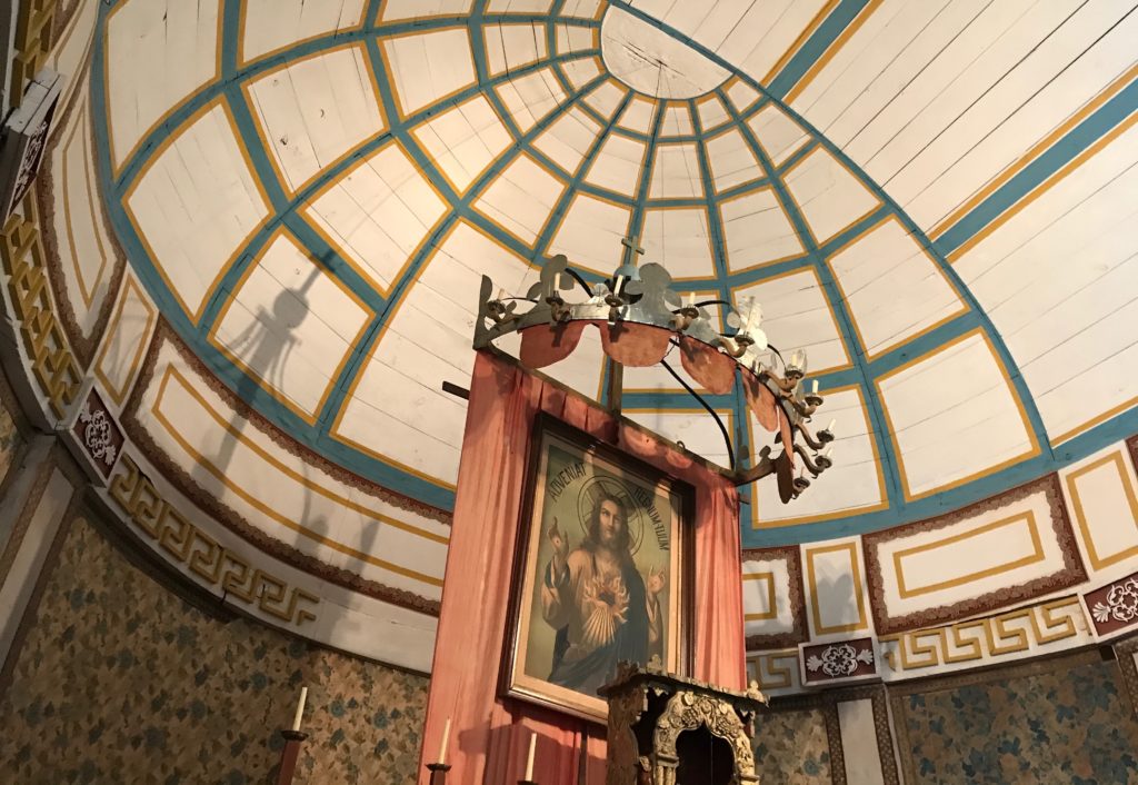
On our way there, we noticed a small white columned chapel on a high hilltop. A road sign read “Old Mission State Park.”
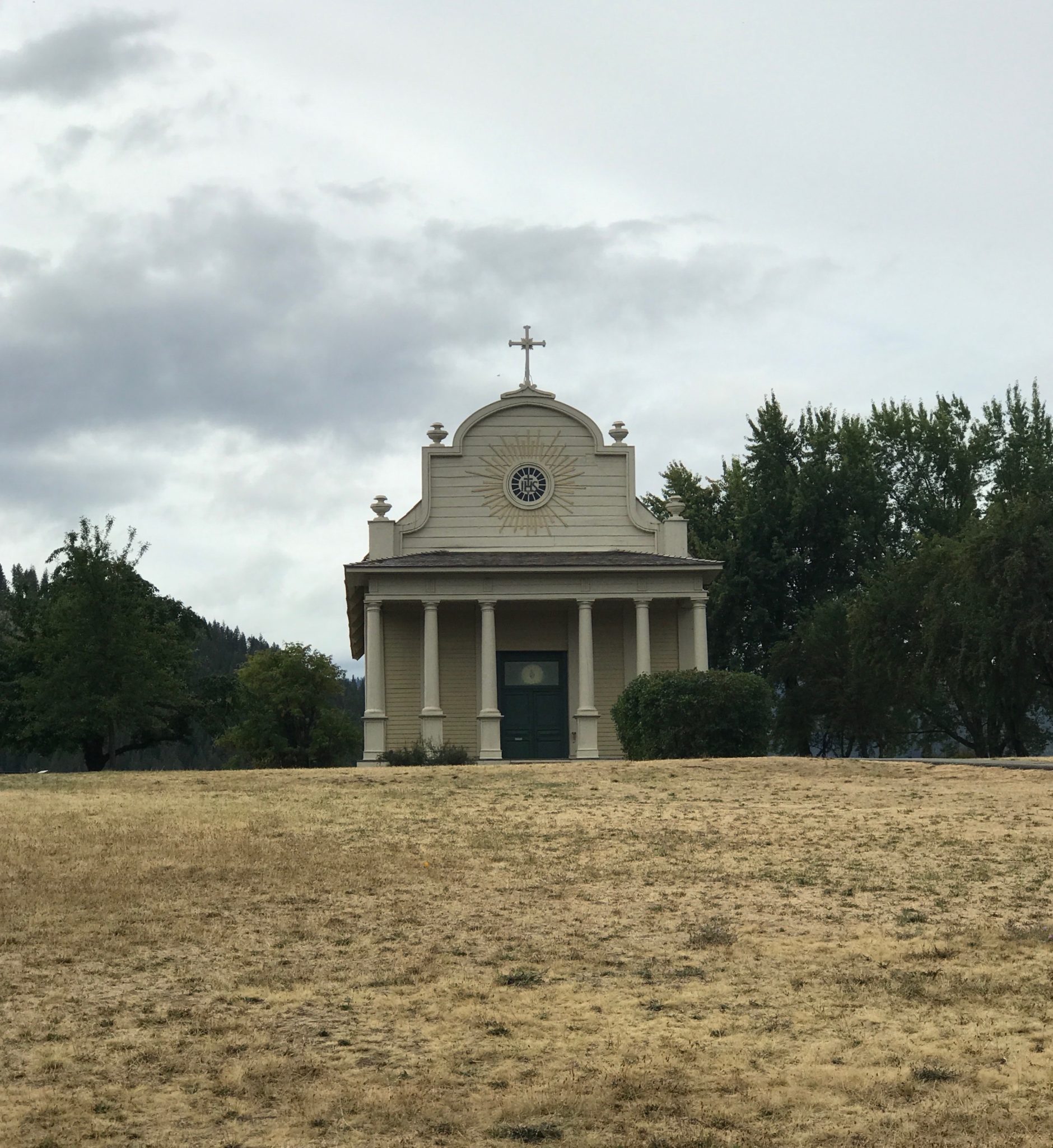
Reason enough to see this small gem overlooking the Coeur d’Alene River. Touted as the oldest standing structure in Idaho, Cataldo Mission was built by Jesuit missionaries and members of the Coeur d’Alene tribe between 1850 -to1853.
Its wooden altar is painted to resemble marble and walls surrounding the altar are covered with crumbling floral wallpaper, a domestic touch. Chandeliers were constructed of tin cans and the chapel’s ceiling is faded sky blue. All in all, Cataldo Mission, listed on the National Historic Register, reminded me of those familiar Texas German and Czech painted churches near Schulenburg and Fredericksburg.
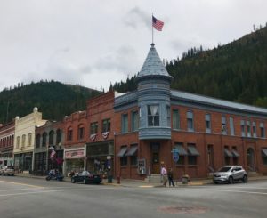
Wallace, Idaho, current population 761, calls itself the “Silver Capital of the World and Center of the Universe.” Wallace is also known for outsmarting the Federal government decades ago. There were plans to extend Interstate 90 right through the center of town. Wallace went to court, and as the case wended its way through the legal system, every single downtown building was added to the National Register of Historic Places.
The Feds had no choice but to alter highway plans and skirt downtown Wallace.
Wallace captures itinerant travelers like Kate and me.
We spent time in the Wallace District Mining Museum, home to a vast cache of memorabilia. We learned that silver mines are dangerous places, and labor strife frequent and violent.
In 1891, striking miners blew up the Frisco Mill. Responding to pleas from mine owners, President McKinley once sent a contingent of African-American Buffalo soldiers to restore order. Today, three mines operate in the area, as the EPA continues clean-up efforts in river and streams, at the behest of the Coeur d’Alene tribe.
One more bit of information from the mining museum: 50 percent of the silver found in those Idaho hills is used by industry, including the making of circuit boards inside our trusty cell phones.
Wallace is also noted for its long history of flourishing bordellos.
In fact, we visited the Oasis Bordello, an establishment that did not close its doors until 1988. Historian Dr. Heather Branstetter wrote Selling Sex in the Silver Valley, and relates that sex work in Wallace was in sync with a Wild West libertarian ethos from 1884 until 1991.
Wallace madams were philanthropically inclined; they bought uniforms for the high school band and a scoreboard for the football team. It’s been said of Wallace, “You don’t have to obey the laws, but you do have to follow the rules.”
Wallace has created a half dozen good reasons for making the town a stop-over, including that manhole cover designated Center of the Universe. It was mid-afternoon before we hit the road toward Flathead Lake in northern Montana.
Our brother called and marveled, “You’re still in Idaho?”
Gazing at Glaciers
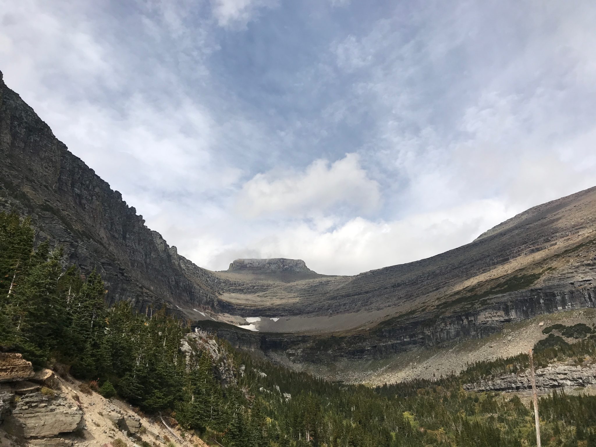
The next morning, we changed to Rocky Mountain time and made our way toward Glacier National Park, an inestimable destination to which I’d not given much forethought. Kate said I was in for a grand surprise.
We encountered a smoky haze in the sky from forest fires in the park and discovered that fires had led to closure of the western entrance to the breathtaking Going-to-the-Sun Road. We veered southward to access this memorable road from the east.
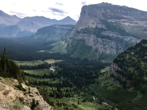
The Rocky Mountains are spectacular. There is nothing transitory about this landscape called “the backbone of the world,” home of the Blackfeet People for millennia.
Glacier National Park, a jewel that belongs to every American, was designated a national park in 1910.
In 1932, partnering with Canada, the park added Alberta’s Waterton Lakes area and in 1995, the park became the world’s first International Peace Park World Heritage Site.
Known for its monumental jagged glacier-formed mountain peaks and emerald lakes, Glacier National Park extends for 1,600 square miles. Six of the park’s mountains are over 10,000 feet high. Hikers have 730 miles of trails to explore, along with the distinct possibility of bear encounters. Last year, Glacier National Park welcomed over three million visitors.
We loved this place that is held by the Blackfeet People as revered sacred space. Most sacred of all is Chief Mountain, in the northeast corner of the park, near the Blackfeet Nation land.
The Blackfeet call this mountain Ninaistako, home to spirits and great power. Blackfeet reside to the east of the park; Kootenai, Salish and Pend d’Oreille tribal lands are west of the park. Visitors can learn more about the people who have called this land home for centuries at St. Mary Visitor Center, which offers an American- Indian perspective of the park.
Glacier National Park is glorious, and I was saddened to see melting glaciers and the devastation of forest fires. Here and there, whole mountains are stripped of all but blackened tree trunks. Sometimes, we saw new green conifers, just several feet tall, beginning to fill the emptiness.
As for the glaciers? Those mighty blocks of ice that began to form 7,000 years ago? Computer models predict they will vanish by 2020. In 1850, there were 150 glaciers on what is now park land; in 2012 there were but 25.
The well-loved Going-to-the-Sun Road cuts east/west through the center of the park and is a must-see drive. Before the road was built, the route was used by indigenous people as the optimum way to cross these Rocky Mountains.

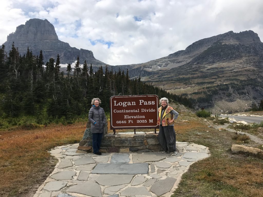
Kate and I drove this two-lane upward winding road toward Logan Pass and the Continental Divide, awestruck at every twist and turn by magnificent vistas.

Logan Pass is the highest point on Going-to-the-Sun Road and the place where waters on the western side of the mountains flow to the Pacific Ocean, and waters on the east flow downward both to the Arctic Ocean and the Gulf of Mexico.
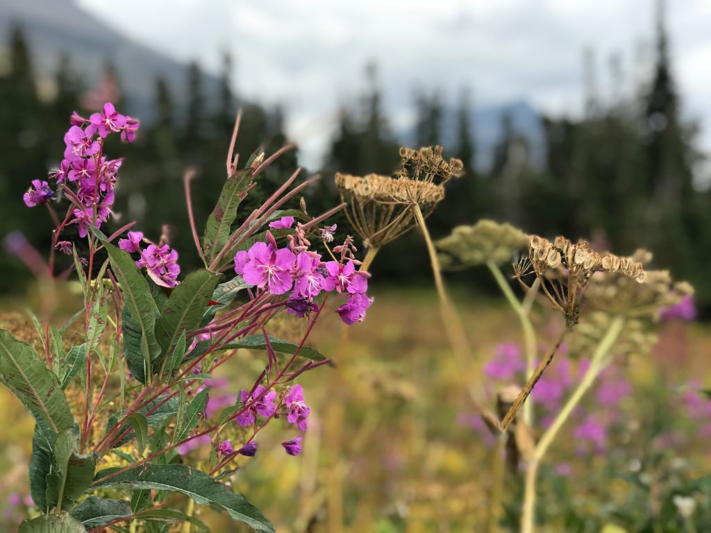
And here we stood at an elevation of 6,646 feet in a meadow of ferociously blooming wild flowers.

The growing season is short and in mid-September, the temperature was 48 degrees. Logan Pass is open to visitors from summer until mid-September. We’d made it just in time.
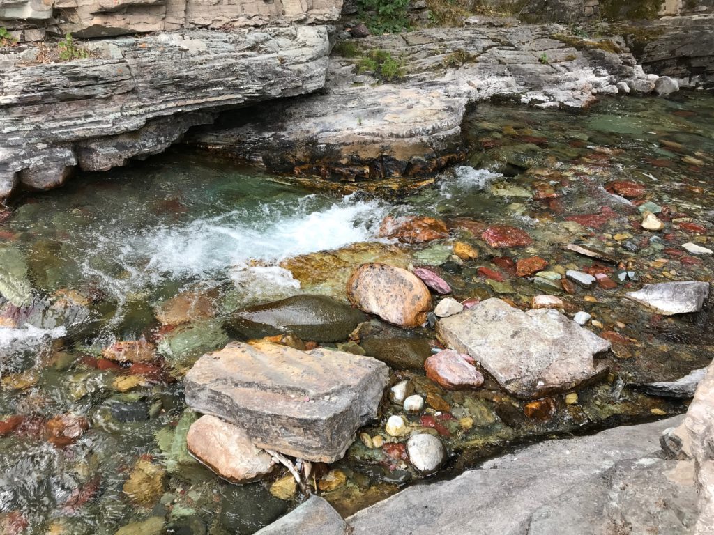
As we retraced our route, Kate stopped the car at pull-outs again and again, the better to absorb the vast scope of these Rocky Mountains with its deep valleys, waterfalls and velvety blankets of conifers. Just past a stone bridge, we walked down steps to see the water rushing below, bubbling over smooth magenta, orange and green rocks.
The very sound of the water put us in an altered state. Until, rounding a corner, we caught sight of this stream headed for a long stretch of blackened tree trunks.
Glacier National Park is not to be missed. It is magnificent; its beauty and majesty envelop. The place also gives off a silent, potent message of distress.
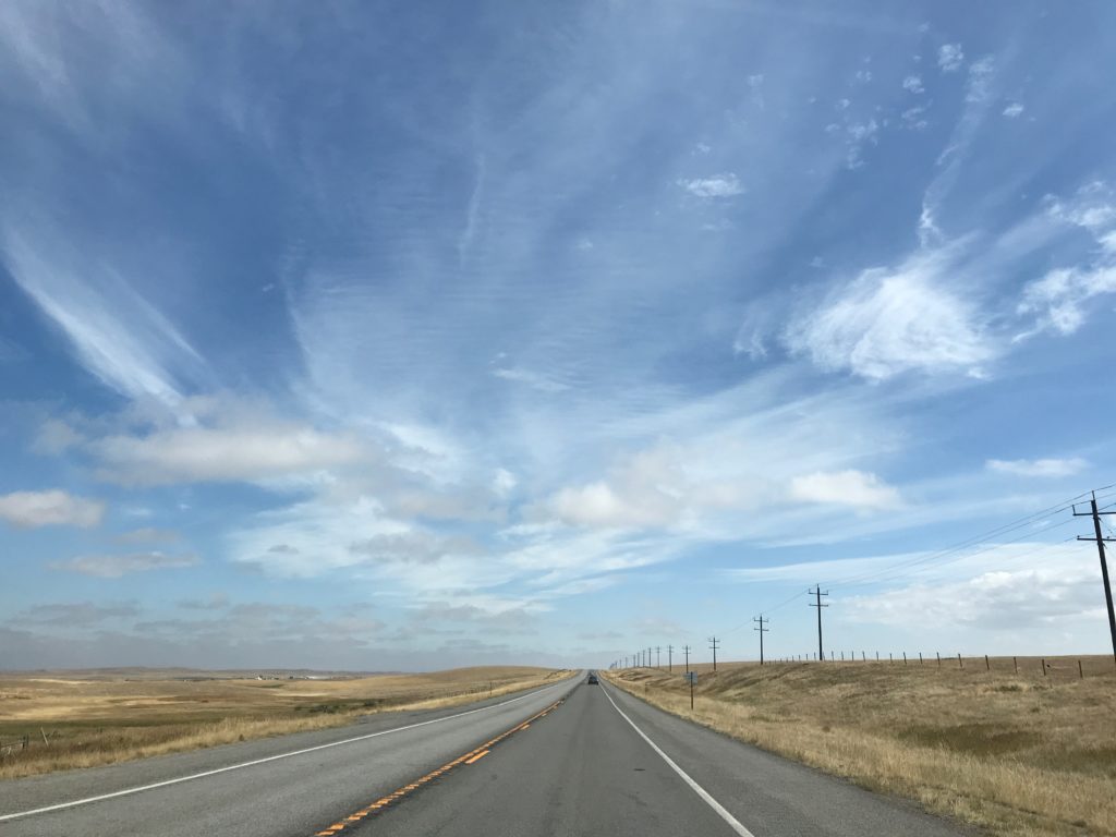
We spent the night on the eastern edge of the park and in the morning, headed across northern Montana. Within an hour, the mountains were behind us. We’d reached golden prairie and the Montana Hi-Line, a flat and seemingly endless stretch of highway that never takes a turn.

Toward afternoon, we’d cross the border north into Canada. Waiting for our arrival was the land our grandparents homesteaded so long ago.
Check back for part two of Mary Margaret Hansen’s Canadian road trip and homecoming.


_md.jpg)


_md.jpg)